In This Guide
A Hidden Gem for Adventure
Nestled amidst breathtaking landscapes, Mount Sawi emerges as a hidden gem for hiking enthusiasts seeking an off-the-beaten-path adventure. With its rolling green hills, sweeping valley views, and a serene river cutting through the terrain, this destination offers a perfect blend of natural beauty and challenging trails. Unlike deeply crowded hiking spots, Mount Sawi retains an untouched charm, making it an ideal escape for those looking to reconnect with nature.
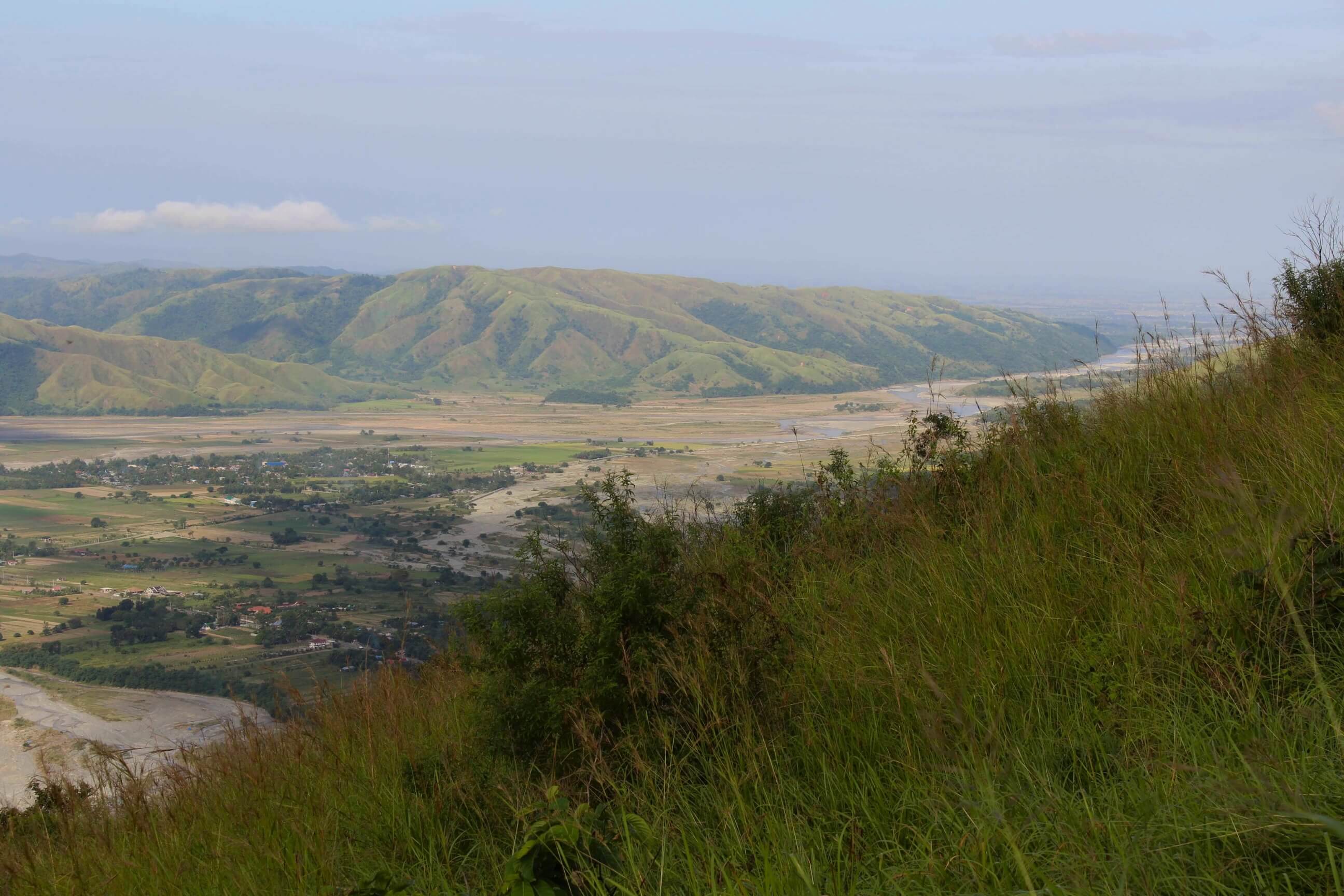
The panoramic vistas from the vantage points reveal a patchwork of lush fields, distant mountains, and quaint villages below—scenes that promise unforgettable memories for photographers and adventurers alike. Whether you consider yourself a beginner eager to conquer your first trail or an experienced hiker craving a new challenge, Mount Sawi’s diverse terrain caters to all skill levels. This guide walks you through everything you need to know to plan a safe and highly rewarding journey.
Best Hiking Trails on Mount Sawi
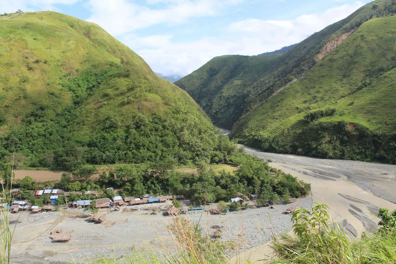
Standing at 594 meters above sea level (MASL) in Gabaldon, Nueva Ecija, Mount Sawi rewards adventurers with stunning views of the Sierra Madre foothills, Dupinga River, and the wide plains of Central Luzon. Known for its beginner-friendly terrain, this mountain functions as a fantastic day-hike destination, typically taking 2-4 hours to summit and descend.
Easy Trails for Beginners: Malinao Route
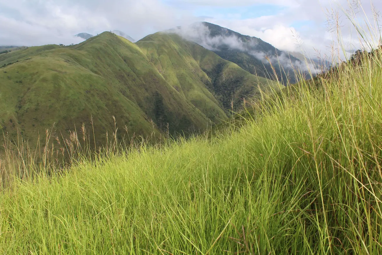
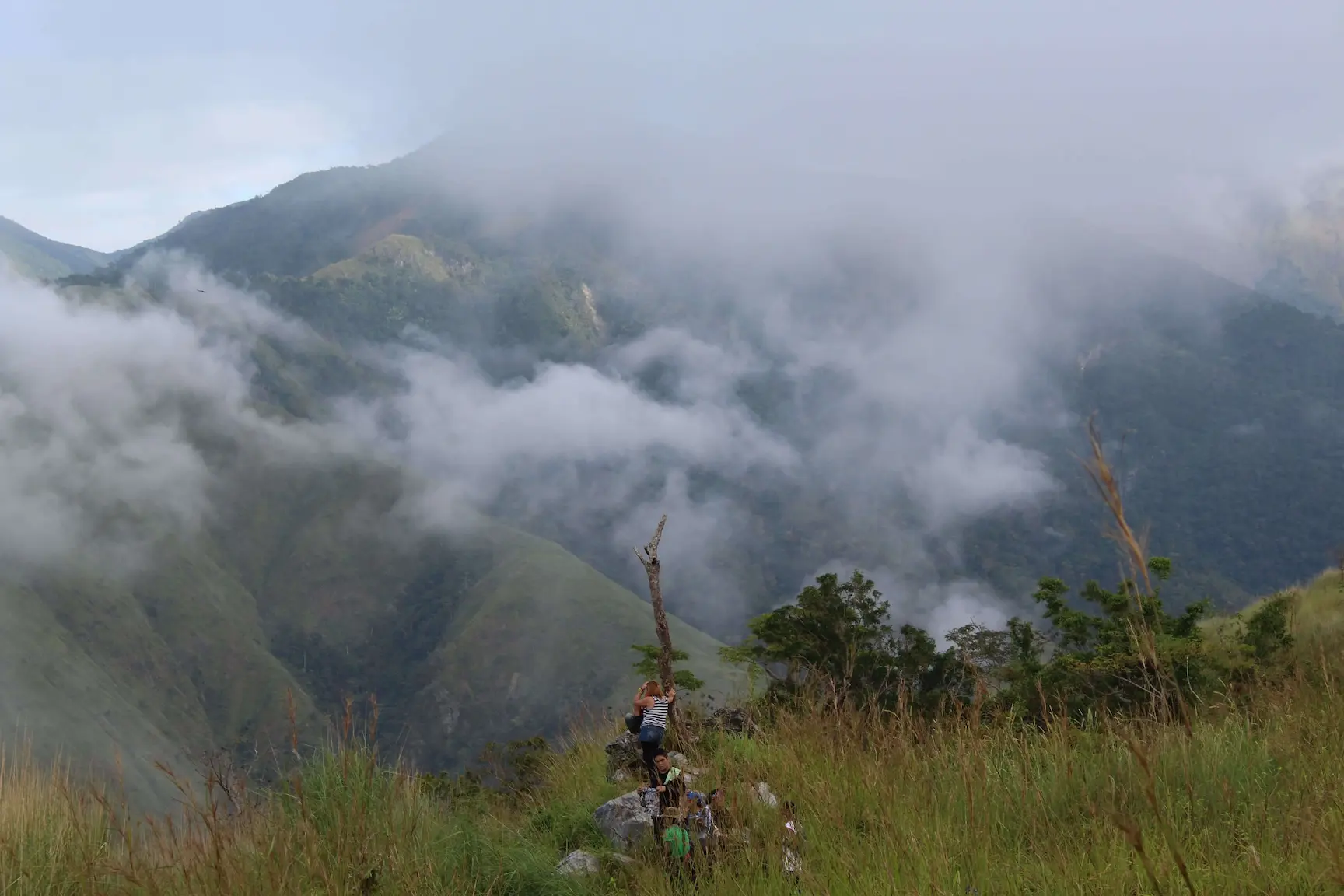
The most popular trail starts at the Barangay Malinao trailhead. This Malinao Trailhead Route forms an out-and-back path, documented as 6.0 km long with an elevation gain of 453 meters. The hike begins with a gentle walk through open farmland before transitioning into a moderate ascent on a narrow ridge. This ridge offers early views of Gabaldon’s fields, serving as great motivation for first-time hikers. As you progress, the trail transforms into a beautiful expanse covered in tall talahib grass.
The summit plateau provides a commanding view of the town of Gabaldon and the Dupinga River. The entire hike typically takes about 2 hours and 30 minutes to complete. Hikers often start early—around 4:45 AM—to avoid the intense heat, as the upper sections completely lack tree cover. Registration at the Barangay Malinao hall requires a small fee (30 PHP per person), and local guides charge roughly 300-500 PHP for groups of 5-10 people.
Challenging Routes: The Steep Ridge Ascent
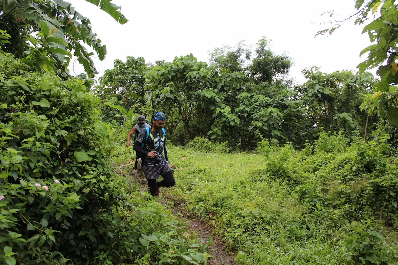
For those seeking more intensity, the Steep Ridge Ascent offers a demanding variation. This section focuses heavily on the initial ridge climb. The trail starts on a rough road, quickly pushing hikers onto the steep ridge. This portion forces many to pant and take short breaks every 10 minutes. After an hour of climbing, the trail luckily levels out into a flat footpath alongside a dipterocarp forested slope, offering a vital breather before the final push.
Mount Sawi Difficulty: What to Expect
When planning a hike, understanding the difficulty level prevents unpleasant surprises. Mount Sawi earns frequent recommendations for beginners, but the mountain still presents challenges.
Elevation and Trail Length
At 594 MASL, Mount Sawi ranks as a relatively low-altitude hike. The 453-meter elevation gain creates a moderate climb. The elevation increases gradually for the most part, but the initial ridge ascent hits hard and steep.
Weather and Exposure
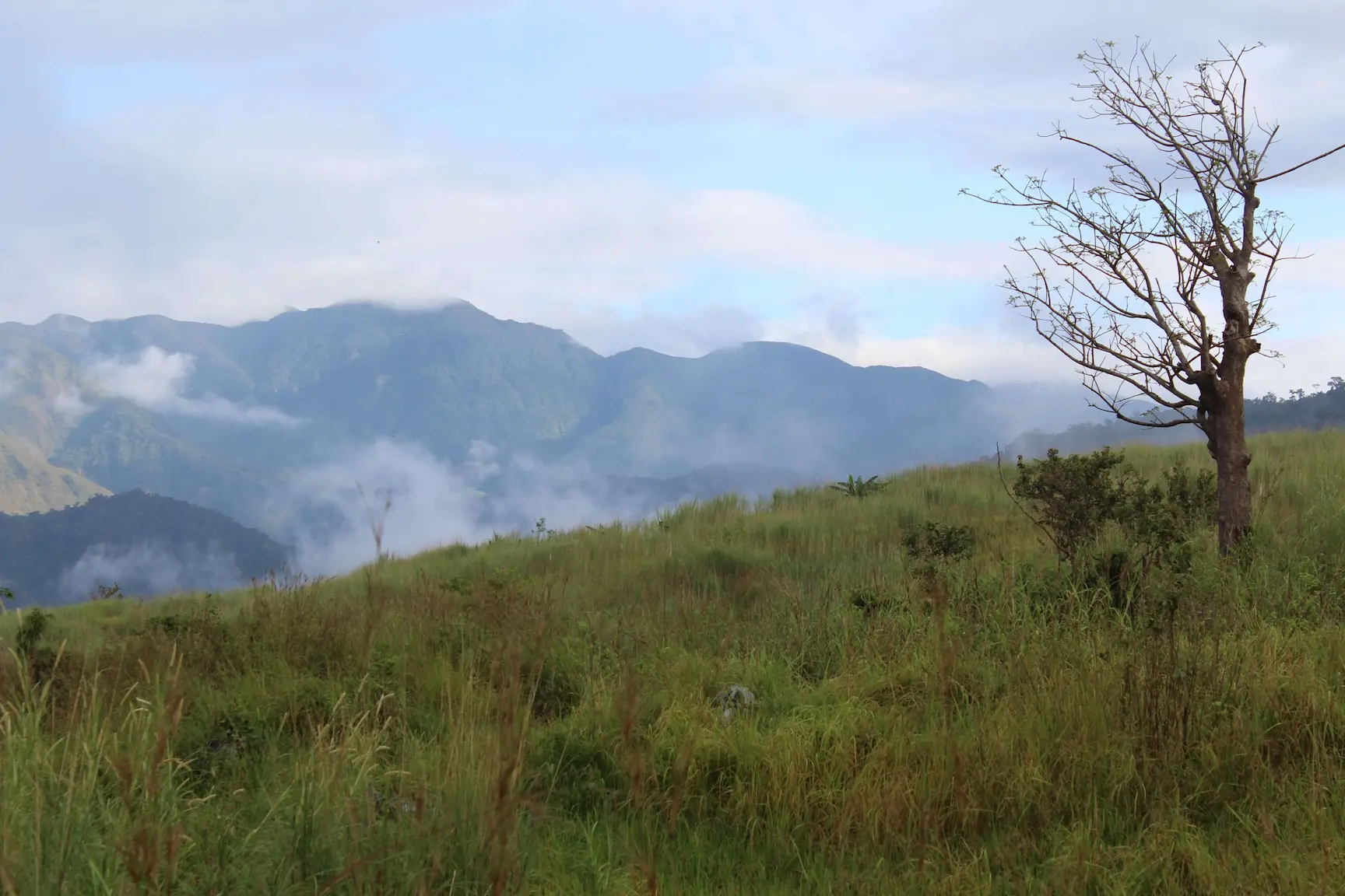
The upper sections completely lack tree cover, making weather a significant factor. The grassy plateau leaves hikers fully exposed to the sun or wind. Temperatures rise quickly, especially from March to May during the dry season. Always bring enough water (at least 2 liters) and wear sun protection.
Overall Difficulty Rating
Mount Sawi rates as a 3/9 difficulty on the Philippine hiking scale. The trails do not require technical skills like rock scrambling or rope climbing, but the steep ridge and sun exposure add a moderate physical challenge.
Scenic Highlights and Photo Spots
Panoramic Valley Views
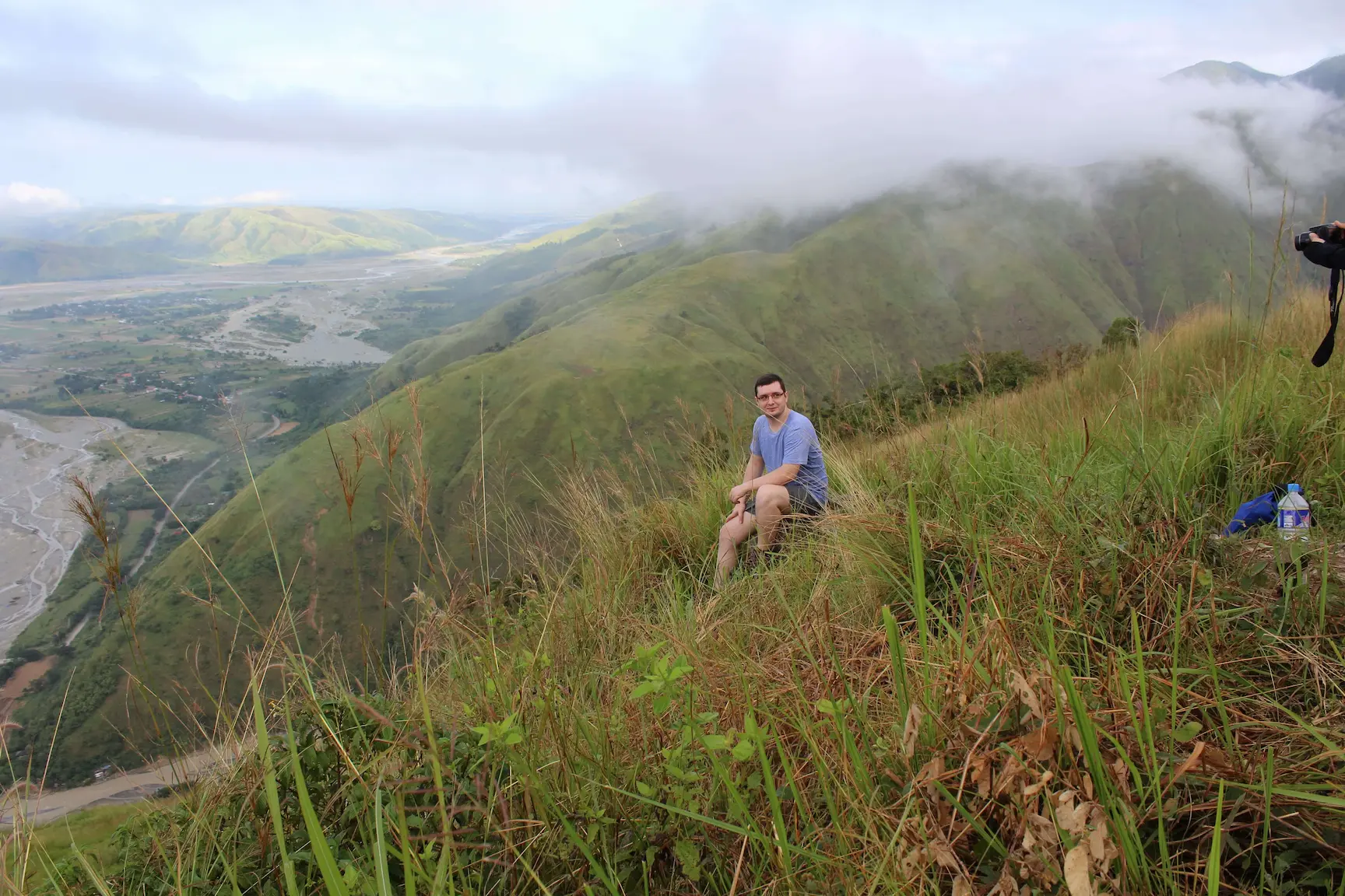
One of the most breathtaking highlights remains the panoramic view of the valley and the Dupinga River. The trail opens up to reveal a sprawling valley flanked by the massive Sierra Madre foothills. Aim to reach this spot around sunrise or late afternoon for golden-hour lighting. Bring a tripod to stabilize your camera when capturing the small village nestled at the base.
Best Sunrise and Sunset Spots
The grassy plateau near the summit serves as the absolute prime location for sunrise and sunset photography. Start your hike by 4:45 AM to catch the sunrise casting a soft glow over the rolling hills. For sunset, linger at the summit to photograph the dramatic silhouette of the landscape. Pack a light jacket, as the wind blows chilly at these times.
How to Get to Mount Sawi?
By Public Transportation
Start your journey from Cubao, Quezon City, by taking a bus bound for Cabanatuan City. Operators like Five Star or Genesis offer this route, with fares around ₱185-₱202 and a travel time of 3-4 hours. From Cabanatuan City Terminal, transfer to a van heading to Gabaldon (₱80-₱90, taking 1.5 hours). Ask the driver to drop you off at Malinao Barangay Hall. Vans wait until full, so expect delays early in the morning.
By Private Vehicle
If driving, set your GPS to “Malinao Barangay Hall, Gabaldon, Nueva Ecija”. The trip from Manila takes about 4 hours via the North Luzon Expressway (NLEX) and the Maharlika Highway. Parking spaces sit near the barangay hall. Register with a fee of ₱30 per person and hire your guide before starting the trek.
Nearby Attractions
Dingalan, Aurora (White Beach & Lighthouse)
Just a 45-minute ride from Gabaldon, Dingalan offers a stunning white-sand beach and a picturesque lighthouse. Rent an outrigger boat (₱1,500-₱2,000 for a group) from the Dingalan Feeder Port to reach White Beach. The Batanes-like scenery provides incredible photo opportunities.
Minalungao National Park
Located roughly 2 hours from Gabaldon, this park features massive limestone cliffs and an emerald river perfect for swimming and bamboo rafting. Read the full guide to Minalungao National Park here.
Gabaldon Falls
A hidden gem within Gabaldon, this waterfall sits about 45 minutes from Malinao. Surrounded by thick, lush vegetation, the cold water provides the ultimate post-hike swim.

Start your Mount Sawi hike early around 4:45 AM from Malinao to catch the sunrise and avoid the brutal midday heat. Register at the barangay hall to secure a guide for a much smoother trek.
Pack sturdy shoes, at least 2 liters of water, and strong sun protection, as the grassy summit offers absolutely zero shade. After conquering the summit, soothe your muscles with a quick side trip to the freezing waters of Gabaldon Falls.